Caves Of Rockcastle County
By: James R. Rebmann and Gary O’Dell
Originally printed in the book "Cave of Rockcastle County", 1972
PURPOSE
This research report is the result of years of hard work by people spending
their recreational time doing something a little different, perhaps a little
strange. It deals with the underground; the dark silent world, where humans do
not belong. They are intruders, unwelcome strangers in perhaps the last
wilderness. The purpose of this paper is to combine the speleological knowledge
of Rockcastle County into one book so that the information will be recorded
enabling others to use what some have gained. This book is to be for the
Speleologist, the serious explorer; it is for those who value caves and
understand the need for their preservation. This is not intended to be a "seed
catalogue" cave publication, a listing and guidebook to Rockcastle caves. It is
not for the vandal, the thrill-seeker, the casual explorer. This is not to
degrade those who enter caves for the sake of exploration alone. The explorer
has a very valuable place in speleology. The difference between the serious
explorer and the thrill seeker can be seen by visiting some popular "wild" cave
and seeing the rape of the cave by those who do not care.
The choice of Rockcastle County for a publication of this type is that the
county has had little public exposure, especially in the speleological field,
and it is close at hand so that it is easy to get to the field. Time is
important as weekends are short.
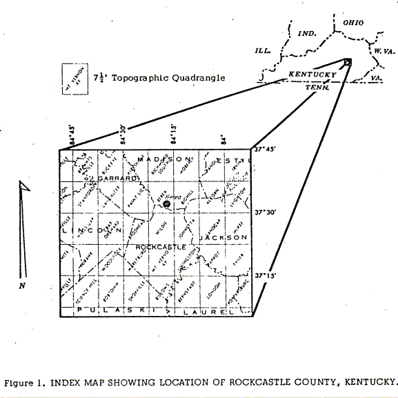
Rockcastle County was formed in 1810 and comprises 311 square miles. It was
formed from parts of Lincoln, Madison, Pulaski and Knox Counties. The geographic
location of this county is between longitude 840 08'N and 840 30'N; and latitude
370 09'W and 370 32'W. The county boundaries today include Garrard and Madison
to the north, Lincoln to the west, Pulaski to the southwest, Laurel on the
southeast and Jackson County to the east.
The overall topography of the county is such that the county can be divided into
two distinct parts. To the east lies the sandstone hills with abrupt sandstone
cliffs in many places. This is the outer edge of the Cumberland escarpment. Here
elevations over 1,5001 can be found, such as Scaffold Cane Knob, Climax Knob,
Wolf Branch Knob, etc. The terrain is rugged, the roads follow the hilltops or
the river bottoms. To the west, the land is more gentle; we get out of the
escarpment and the sandstone cliffs into a rolling landscape. The land is
limestone and is more susceptible to erosion. Occasional knobs are found such as
Copper Knob, Brushy Mountain, and Sutton Knob. The land is more congenial to
habitation and so travel is easier due to more and better roads in the area.
The main cave or karst region is to be found in a northeast-southwest trend
across the county. Here the Mississippian Limestone rocks are found which are
conducive to cave formation. On top of the Mississippian rocks to the east are
the Pennsylvanian sandstone and shales which form the cliffs and high places. To
the west and under the cave forming limestones are found rocks which do not
favor cave formation. Thus we have the greatest selection and variety of caves
following this N.E.-S.W. trend.
It is inevitable that the publication of this will bring about an increase in
the spelean traffic. This is an unfortunate side effect of publication. In every
area that has published speleological material, the caves have suffered.
Nevertheless, people are going to visit caves. It comes to the choice between
two evils; to let our Information become public or to keep it hidden and locked
up. There will always be cave explorers, but if they are careful and
considerate, future spelunkers will have something to look at. A formation is
hardly more impressive in someone's rock garden than hanging in its natural
place. If one wants to see litter and garbage and polluted water, they may as
well remain above ground. There is more of it there.
Background
Cave Development
Karst forms in Kentucky depend on the presence of soluble limestone and the
degree of solubility of the limestone. This solubility varies from place to
place due to the structure and quality of the limestone. The presence of
limestone alone will not be the determining factor for cave development.
Adequate rainfall and sufficient gradiant must also exist. Both of these
conditions are present in Rockcastle County.
Limestone in itself is impermeable to water, though it is soluble in water. The
permeability of the limestone is achieved through an inter connecting network of
bedding plane, and joint fracture patterns produced secondarily in the limestone
by diastrophic forces. Together these joints and bedding planes form a network
by which water is transported subsurface and along which solution takes place. A
perfect example of this in Rockcastle County is found in Joint Cave.
One of the properties of Limestone is that it is slightly soluble in pure water
due to the mineral calcium carbonate of which it is composed. Acids or acid
water dissolve it at an accelerated speed; in pure acid the process is very
rapid and visible. Rainwater before contact with the ground has a very slight
acidity content derived from the presence of carbon dioxide in the atmosphere.
Once the water enters the ground a large amount of carbon dioxide from organic
material in the soil goes into solution. The acid content of the water is then
sufficient to dissolve limestone in quantities enough to form caverns. Most of
the dissolving action takes place in the saturated area under the water table
known as the phreatic zone. Lateral movement of the weak acid-bearing water
enlarges the cracks and thus starts the beginning of cave passages.
Growth Of Speleothems
The caves of Rockcastle County are not known for their Speleothems. To date
no cave has been found with an abundance of formations, except for flowstone.
Some of the caves that had formations now lack them due to wanton vandalism.
The term speleothem refers to "formation" which commonly means stalactite,
stalagmite or column.
These speleothems are formed by a chemical solution or by the solidification of
a fluid Calcite is the main ingredient. Calcite is dissolved from the limestone
by acid water percolating downward. Upon reaching the interior of the cave the
water deposits the calcite and holds it in solution forming a speleothem. The
calcite is precipitated due to the air being saturated with water vapor. The
loss of carbon dioxide from dripping water makes the dissolved calcite
precipitate out of solution. The loss of carbon dioxide, rather than evaporation
of water, is the chief means by which calcite speleothems are formed.
The size and shape of the formations are related to the rate of the loss of
carbon dioxide and the rate of flow of the water.
Erosional Features Of Caves
Along with the progress of chemical aggradation in the making of speleothems
and the chemical dissolving by the acid solution of the limestone to make the
formations there is also some mechanical weathering of the limestone rock. In
Rockcastle County two of the largest features that can be seen with regard to
this process are the formation of dome pits and recessional waterfalls. The dome
pit is formed through seepage in a joint, which allows water to attain a lower
level. The passage is enlarged with water eroding away the sides of the pit
until a balance is achieved between the angle of water flowing over the sides of
the pit and the angle of drop. Once the water is allowed to fall free off the
sides lateral erosion ceases and the dome pit stops growth in a lateral
direction. A dome pit can exist in three different forms. A dome with a pit can
exist, a pit alone or just a dome depending on conditions. An example of a dome
over one hundred feet high can be found in Millers Pit 2. Almost all the caves
in Rockcastle County have examples of this feature as it is almost a basic
development with regard to caves.
Recessional waterfalls usually form large spectacular rooms with a canyon
effect. Mullen Springs Cave has some good examples of this feature. The
erosional qualities of the waterfalls are similar to their surface counterparts.
Other erosional features include cusps, good examples of which can be found in
Sinks of the Roundstone Cave. Natural arches also are found in caves and
especially around the entrances. The entrance arch of Goochland Cave is some
sixty feet high by a hundred wide, formed by massive collapse due to weakened
structural support. The collapse relieves the tension and forms a more stable
structure. The entrance of Millers Pit 2 was formed in this manner, aided by
solution.
Most of the caves that have been mapped and plotted in Rockcastle County are
closely related to the contours of the land, as can be seen in Figure.4. The two
caves, Goochland and Smokehole, have a combined length of over 22,000 feet. They
parallel closely the structure of their ridges in the alignment of their
passageways. This tendency is exhibited to some extent by nearly all of the
caves of the county. Some deviate considerably from this general rule, however,
Millers Pit 2 initially follows the ridge outline but then crosses through,
forming a domepit, and then returns to the opposite side, gradually becoming too
small for exploration.
Geology Of The Cave Belt
The caves of Rockcastle County are found in the Newman limestone of
Mississippian age, which contains a unit also found in the Mammoth Cave region
and other cavernous areas of the state. This member is the St. Louis limestone
which together with the Ste. Genevieve limestone form the basic rocks in which
Rockcastle cavern development takes place. In the eastern portion of the county
the escarpment is composed of the Lee conglomerate which forms most of the high
ridges and cliffs. The Pennington formation is the top of the Newman and
contains a few caves, most of which tend to penetrate downward into other more
suitable limestones. Figure 5 is a geologic column of the central part of
Rockcastle County, adapted from the Mount Vernon 7 1/2 minute geologic
quadrangle.
The rocks of the county are slightly tilted, dipping to the southeast. As a
result the major cave development is confined to a belt along the eastern and
southeastern edge of the county where the Newman is exposed at its greatest
thickness. East of this belt the Newman is deeply buried with only the
Pennington remaining exposed which contains numerous shale and clay beds,
effectively limiting cave development. To the west of the cave area the less
resistant limestone of the Ste. Genevieve and St. Louis are more exposed and as
a result most of the soluble rock has long since been eroded away. As one leaves
the "cave belt" the caves become smaller in all dimensions until they can only
rarely be found. Some of the knobs may contain caves or pits as the Lee in that
area forms a protective cap, preventing erosion of the underlying limestone.
Hydrology And Topography
No study of the caves of any county can be complete without a look at the
hydrology of that area. Water is the most important factor in the shaping of
caves. This is intended to be a brief summary.
Limestone terrains are unstable in comparison with other types of bedrock due to
their solubility. This, along with the relative impermeability of limestone,
comprises the basis for cavern development. Together with surface and subsurface
features limestone terranes are called karst areas.
The nonpermeability of these rocks presents an unusual sort of aquifer in areas
underlain by limestones. Water cannot penetrate the rock itself so it is forced
to seek spaces between the rocks. This sort of "permeability" is typical of the
Kentucky-Tennessee region and is achieved through the interconnecting network of
a joint-fracture pattern. Faults play so insignificant a role in the cave
development of the county that they may be totally disregarded. One notable
exception to this is Up and Down Cave which is aligned along a small strike-slip
fault. Joints are vertical cracks in the limestone occurring every few feet.
They are subject to some stress and slight movement and are significant to the
development of cave geometry. Partings are parallel to the bedding plane.
Together joints and partings comprise the network along which solution takes
place.
The acid chiefly responsible for dissolving the limestone around these joints
and partings is carbonic acid, produced from carbon dioxide and water. Water,
usually in the form of precipitation, enters the ground and comes in contact
with carbon dioxide formed from decaying organic matter in the soil. The carbon
dioxide is dissolved under subsurface pressure into the water.
After initial production the carbonic acid enters the fractures and begins
dissolving away at an extremely slow rate. Most of this solution takes place in
the saturated area under the water table known as the phreatic zone. Lateral
movement of the weak acid bearing water enlarges the horizontal cracks, the
earliest beginnings of cave passages.
When any particular fracture reaches a critical diameter-about a quarter of an
inch, the water flow becomes turbulent and the rate of solution increases. The
channel enlarges at an accelerating speed, robbing its slower neighbors, so that
eventually it may become a full fledged cave passage.5 Solution channels of
advanced development may be seen on the Interstate 75 roadcuts near the Mount
Vernon exits.
In addition to the chemical dissolving by the acid solution there is also some
mechanical "weathering" of the passage. Clastic sediment carried by the channel
is constantly abrading the walls.
Sulfuric acid, as a by-product of strip mining operation and naturally formed in
areas containing sufficient quantities of pyrite or marcasite, also plays a part
in cavern development. Sulfuric acid in contact with limestone forms gypsum,
CaSO4. The rate of solution does not vary seasonally as does the carbonic acid
reaction.
The last major step of cave development, preceding stream piracy, is the
lowering of the water table. Up to this point, large cavities may have been
dissolved out of the limestone that are structurally sound as long as they are
entirely filled by water. Upon the draining of that water the passage is no
longer supported by the dense medium and is unstable. This results in ceiling
and some wall collapse. A sink hole entrance may develop in the new ceiling,
depending upon the thickness of the overlying rock.
The rainfall over the south central portion of Kentucky averages between.
forty-six and fifty inches annually. Evaporation and plant growth return
twenty-nine inches of the total back into the hydrological cycle before it is
assimilated into the ground water system.7 Exact figures for runoff are not
available but assuming thirty percent of the water remaining after
evapotranspiration enters the ground immediately after falling, this allows for
2.14 x 10^9 gallons or 2.89 x 10⁹ cubic feet to join the ground water annually.
A cubic foot of water exposed, until the reaction ceases, to limestone and air
containing ten percent carbon dioxide will dissolve about a quarter of an ounce
of limestone. Twenty-one billion gallons of acid water is capable of dissolving
roughly forty-three million pounds of limestone in a year. In more easily
pictured terms, this could produce a cave five feet squared by thirty feet long
under every square mile in the county every year.
In Rockcastle County the divide between the Kentucky and Cumberland River
drainages crosses in a north-easterly direction. The Kentucky River drainage is
represented by the head waters of Dix River and its branches, while the
Rockcastle River with its branches represents the Cumberland River drainage. The
Cumberland River drainage covers about three-fourths of the county. The largest
stream within the county is Roundstone Creek. The chief branches of this creek
are Renfro, Clear, Brush and Crooked Creeks. The two creeks with the most
influence on karst formation are Crooked Creek and Roundstone Creek. Figure 6
shows the relationship of hydrology and topography and the location of caves in
central Rockcastle County. The blue exposure in the figure represents the area
of Newman Limestone that is exposed to the surface. This is the cave forming
limestone. The county can be divided into three physiographic regions with
respect to rock exposure and hydrology. Starting from the east along the
Cumberland escarpment one would expect to find caves.
One finds youthful caves in the Crooked Creek drainage area. The limestone is
the thickest here and here the caves are the longest and most numerous. As one
goes west in the county the limestone becomes thinner as the topography becomes
less rugged through prolonged erosion. As one proceeds west the caves go from
youthful to mature and finally to old age in the western part. Here the Newman
limestone has been eroded away to the bottom of the St. Louis Limestone and
Renfro Member of the Borden Formation, where cave formation can not take place
as readily as before.
The pattern of drainage is of a normal dendritic type in the county except for
the part located in the youthful karst region. Here the streams exhibit the
normal sequence of a karst landscape. A short surface exposure and then
underground to later reappear at some other place. As the escarpment retreats
and the topography is eroded away the streams will reappear as surface streams.
Biology
Most of the cave biota observed in Rockcastle County is of the transitory
animal type, or trogioxenes. This includes diverse anthropod species, small
mammals, some reptiles, and occasional birds.
Cave rats (Neotoma) similar to pack rats are found in most caves of the area..
Direct observation has been made of these in Neotoma’s Nest Cave and Rat Run
Cave. Evidences of rat inhabitation, such as acorns far from any surface inlet,
nesting materials, and rat excrement, are common in many caves. Goochland,
Smokehole and Owens Saltpeter all show signs of extensive rat populations.
Snakes have been found in and about entrances, notably copperheads in the lower
areas and blacksnakes higher in the ridges. The presence of snakes and turtles
(Turtle Pit) at the bottom of some pits can be assumed to be accidental.
Amphibians are often inhabitors of the entrance zone, and occasionally have been
found deep within caves in wet, muddy passages.
Troglobitic insects are primarily inhabitors of the entrance and twilight zones,
although some, such as cave crickets are found throughout the caves. Both
Jadenoecus Subterraneous and Ceuthophilus Styglus crickets have been found in
Rockcastle, often both together. Plate I shows two mating crickets of the tan
variety. Spiders are common cave dwellers, the most frequently found are the
common wolf spider and the tannish, shiny web weaving Meta Manardii (Web In
Plate 2). Other anthropods include mud-dauber wasps who build their tubular
nests at the entrances; earthworms; millipedes; centipedes; crayfish, both
normal brown and white eyeless (a brown crayfish was found 8,000 feet inside
Goochland); and numerous small species who seldom travel past the twilight zone.
Bats are perhaps the most frequently observed life forms In Rockcastle County
caves. There are many species found in the county but the only two so far
identified are the small solitary pipistrels and the Indiana cluster bats.
Several thousand of the latter may be seen inside Smokehole Cave for they
cluster close to the entrance during the day. Birds are sometimes seen nesting
in cave entrances.
True troglobitic forms are best represented in the county by several species of
beetles. A list of identified specimens and their collection locales appears in
Appendix S.
Plants do not occur naturally in the caves except for some varieties of fungus
which grow on the excrement of foxes and raccoons.
Any other plants seen are accidental transports and are short lived.
Micro-organisms were collected only inadvertently and studied not at all.
The gathering of information is always a long hard task. Needless to say, this
work was completed only after countless hours of work. For several years now
people have been working in Rockcastle County gathering information on the caves
as to location, maps and whatever else is pertinent to the caves. After so much
work had been done it was decided to get it together and create something to
justify the amount of work that had already been done.
One of the first works on the caves of Rockcastle County came from a report by
W. Russell and T. Costello from the Texas Speleological Survey and was printed
in 1962. It contained about twenty caves and had write-ups and a few maps of the
caves. Today we have over one hundred and thirty caves in the county and work is
still going on. It will probably never stop. The average for the past six months
has been a new cave being found each weekend. In time perhaps another one
hundred caves may be added to the list.
Through the use of topographic, geologic maps and sometimes aerial photographs
we were able to locate the karst areas and have a plan as to which areas to
investigate.
Winter time is especially conclusive to cave location as the vegetation is
stripped from the trees. The ideal time to locate caves is on a cold day about 5
F or less. The moisture from the cave entrance creates a frost cover on the
surrounding vegetation and this produces a virtual signpost as to the location
of a cave.
Meeting other spelunkers had its advantages. Notes were compared and “new” caves
were located. Sometimes the more advanced cavers had maps of the caves he had
visited. Many farmers in the area were helpful in giving directions to the
caves.
The mapping of the caves was carried out using a compass and some sort of
measuring device. Most of the caves were mapped with a Silva compass, or Brunton,
and a tape or range finder and tape. In many places photographs were taken to
record the cave environment. Clinometer readings were taken where applicable.
<end>